Bike and Vehicle Routes and First Dip Alternative Route
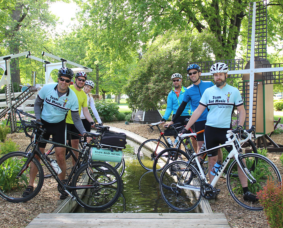
For those riders who wish to dip their tires, we will have two areas to do so. First, we will be transporting water from the Missouri River and filling the canal in Windmill Park! This will provide a unique photo opportunity to begin RAGBRAI, as several windmills line the canal.
Second, for those who need to dip on the western Iowa border, we have arranged for the safest and shortest route. The dipping site is Carr’s Landing in Hawarden along the Big Sioux River. There is a boat ramp to the river. Directions to Carr’s Landing from the main campground in Orange City (31 miles): take Albany Ave south two miles to B58 (470th St) and head west. Go thirteen miles to Ireton. Turn north at Ireton on K30 and travel two miles to Highway 10. Continue north for three more miles to B46 and turn west. Go seven miles to Cherry Ave (K18) and turn south. This turns to the west. Turn right on 23rd St and travel 1 mile to Highway 10. Turn south and go two blocks to 21st street and turn west. Go one block to Ave D, then north one block to 22nd St, and west one block to Carr’s Landing. Reverse the route to return. We plan on marking the route to assist you. This will keep you off Highway 10, which will be busy and unsafe the opening weekend of RAGBRAI.
Riders may utilize any of the four main entrances into Orange City. K64/Albany Ave North & South OR Highway 10 East or West. Information booths will be set up at each entrance to help riders with logistics
![]() Click on any of the markers to see more information. You can also get directions from your location by clicking on the “Get directions” link on each marker.
Click on any of the markers to see more information. You can also get directions from your location by clicking on the “Get directions” link on each marker.
[wpgmza id=”1″]
Teal line represents bike route out of Orange City.
Sky blue line represents vehicle route out of Orange City.
Red line represents alternate bike route to and from Missouri river to Orange City.
Bike and Support Vehicle Route Out Details
The map here is to assist you in exiting Orange City safely and efficiently.
Riders, you will be exiting Orange City via Albany Ave and headed south. Drivers, you will be exiting Orange City via Albany Ave headed north.
Use the vehicle route suggestions in green to avoid congestion as you exit our town and head to your next over night destination.
Stay safe!
[wpgmza id=”8″]
Teal line represents bike route out of Orange City.
Green line represents vehicle route out of Orange City.
![]() Click on any of the markers to see more information. You can also get directions from your location by clicking on the “Get directions” link on each marker.
Click on any of the markers to see more information. You can also get directions from your location by clicking on the “Get directions” link on each marker.
Campgrounds
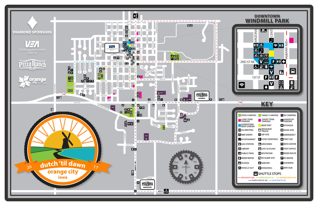
This Map shows the open camping areas (in green), RV parking areas, shower facilities & RV dump stations.
![]() Click on any of the markers to see more information. You can also get directions from your location by clicking on the “Get directions” link on each marker.
Click on any of the markers to see more information. You can also get directions from your location by clicking on the “Get directions” link on each marker.
[wpgmza id=”3″]
Parking
[wpgmza id=”2″]
This map indicates parking areas for Long Term Parking (permit required can be purchased day of on-site) and Short Term Parking areas.
![]() Click on any of the markers to see more information. You can also get directions from your location by clicking on the “Get directions” link on each marker.
Click on any of the markers to see more information. You can also get directions from your location by clicking on the “Get directions” link on each marker.
Shuttles
This map follows the different shuttle routes that will service the Main Campgrounds, Family Camping area, RV parking lots & stops to some of the larger charters. Each route will bring you downtown and are color coded to specific areas. Bus Shuttles will begin running Noon to Midnight.
Color Codes
Pink Shuttle Route – Stops at Landsmeer Golf Course (Pork Bellies Charter), OC Swimming Pool (Showers and Camping) and 1st St Downtown (Bike Expo, Beer Garden & Entertainment)
Purple Shuttle Route – Stops at MOC-FV High School (Showers and Parking), 8th St SE RV Parking, OCAHS Camping, 14th St SE RV Parking, Main Campground & 3rd St & Central Ave South -Downtown (Bike Expo, Beer Garden & Entertainment)
Green Shuttle Route – Stops at Main Campground and 3rd St & Central Ave South -Downtown (Bike Expo, Beer Garden & Entertainment)
Orange Shuttle Route – Stops at Orange City Christian School (Family Camping Area) and 3rd St & Central Ave South -Downtown (Bike Expo, Beer Garden & Entertainment)
Blue Shuttle Route – Stops at Unity Christian High School (Showers, Camping, and Charter Camping) and 3rd St & Central Ave South (Downtown (Bike Expo, Beer Garden & Entertainment)
![]() Click on any of the markers to see more information. You can also get directions from your location by clicking on the “Get directions” link on each marker.
Click on any of the markers to see more information. You can also get directions from your location by clicking on the “Get directions” link on each marker.
[wpgmza id=”5″]
Downtown
Downtown is where the excitement will be! The RAGBRAI Bike Expo, Bike Shops, Beer Garden, Food Vendors, Entertainment, and RAGBRAI Merchandise tents will all be downtown. The Beer Garden opens at 11:30am and is free and open to all ages.
![]() Click on any of the markers to see more information. You can also get directions from your location by clicking on the “Get directions” link on each marker.
Click on any of the markers to see more information. You can also get directions from your location by clicking on the “Get directions” link on each marker.
[wpgmza id=”6″]
